Physical Address
304 North Cardinal St.
Dorchester Center, MA 02124
Physical Address
304 North Cardinal St.
Dorchester Center, MA 02124

Liberalizing Cities
From The Ground Up

It is because every individual knows little and, in particular, because we rarely know which of us knows best that we trust the independent and competitive efforts of many to induce the emergence of what we shall want when we see it. — Friedrich Hayek, The Constitution of Liberty Imagine the perfect city. If you have a clear picture in mind, you’re not alone. Tsars, emperors, and prophets have been trying to build perfect cities for millennia. With the emergence of the field of urban planning and modern social science, everyone from stenographers to industrialists to independent architects have joined in. For Ebenezer Howard, the perfect city was the Garden City, a corporate-owned residential satellite on the outer edge of town. For Le Corbusier, it was the Ville Radieuse, full of “skyscrapers in the park” and elevated highways. For Frank Lloyd Wright, it was Broadacre City, a dispersed anti-city full of single-family homes on one-acre lots. Each reflects a distinct vision of urban life, and each seems to have as many opponents as it does proponents. Thankfully, few of these plans have ever been implemented in full on a mass scale. Yet “perfect city” thinking—the view that one particular vision of urban form should be imposed by planners—has manifested itself in small ways in cities around the world through the construction and enforcement of specific theories of how a city should work. This approach to urban form involves expanding urban planning beyond prudentially managing infrastructure and mitigating destructive negative externalities and toward enforcing and preserving particular lifestyle and aesthetic preferences. Consider: while Ville Radieuse was never built, many cities bulldozed traditional urban neighborhoods to construct the urban elevated highways of Le Corbusier’s dreams. While Broadacre City never moved beyond the model stage, many suburban communities still zone minimum lot sizes […]

There are many ways to tell the story of urban-policy failure. Economists have shown how rent control creates housing shortages, sociologists how welfare programs destroy poor communities, and urbanologists how urban planning can debilitate cities. In his book The Future Once Happened Here, historian Fred Siegel has added a new and insightful chronicle of modern liberalism’s influence on social policy in New York, Washington, D.C., and Los Angeles over the last 30 years. Siegel identifies racial tension as a main force that has driven urban policy since the 1960s. He lucidly and engagingly describes how that policy, informed by “riot ideology” based on liberal guilt and fear, transformed some major American cities from communities of tolerant strangers and great incubators of ethnic integration into rolling riots and sinkholes of federal largess. Associated with the riot ideology is what Siegel terms “dependent individualism,” the idea that each person has an absolute right to his “lifestyle,” at public expense and regardless of the consequences for social cooperation. Those consequences have been a “moral deregulation of public space,” which has eroded the trust that urbanologist Jane Jacobs identified as the lubricant that permits great cities to work well. The largest part of the book is devoted to New York City. Siegel explains how Mayor Fiorello La Guardia’s success in getting federal aid from FDR’s New Deal in the 1930s set the pattern for fiscal irresponsibility in New York for the next five decades. Consequently, New York became dependent on an artificial, make-work economy, based on federally funded jobs and welfare bolstered by dependent individualism and the riot ideology. Nevertheless, its productive sector was still so large that both New York City and the state of New York have regularly sent more taxes to Washington than they have received in transfers. Surprisingly, supporters of […]
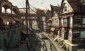
I’ve been enjoying the series Meet the Romans, and episode 2 really revealed what I love about many ancient Roman cities. I’ve been to quite a few, though often without knowing beforehand that they were ancient Roman cities. These include cities like Dubrovnik, Split, La Spezia, Florence, Istanbul, Budapest, and yes, Rome. The attributes I’ve come to love include: 1. very narrow streets, often not accommodating cars 2. countless 4- to 6-story buildings with a variety of units, from cheap tiny units to large family units with courtyards 3. built into the 1st floor of these buildings are tiny shops – everything from restaurants to banks to bakeries 4. in ancient Rome most housing units weren’t used for much more than sleeping – living was done in the city. You often didn’t have a kitchen, laundry facilities, or even a bathroom. The host Mary Beard tells about the horrors of these things (barely enough room to lie down, the danger of dark small alleys), but I think in a modern world they’d be wonderful (ok, keep private bathrooms). Walk to your job, spend time in a vast variety of restaurants or pubs, experience the feeling of a busy narrow street, chat with neighbors at a public park, and take your kids to relax and play at the public bath or let them play in a public square while you grab a cappuccino. This is heaven to me. The only reason most modern cities aren’t like this is because we force them not to be. We require minimum space for all housing types, design our streets for cars instead of people, limit the height of buildings in most places, and separate our retail from our living zones. The effect is to push the less-rich outward, separate us from other people, and […]
People in the American Midwest are said to be on average more conservative and more libertarian than people who live on the East and West Coasts. And that in turn is because people in rural areas are said to be more strongly tied to the traditions of individualism and self-reliance than those in big cities such as New York, Los Angeles, Chicago—who politically are more statist and tend to see government as a first-responder to perceived economic and social problems. We could go back and forth arguing with conflicting evidence on urbanity and ideology that depend on, for example, whether you use “Republican” and “Democrat” as proxies for “right-wing” and “left-wing,” whether you’re comparing states or counties, and so on. So for the sake of argument I will concede that in today’s United States “urban” means statist and “rural” means conservative and libertarian. Does it follow then that people who live in dense cities are necessarily more statist than people who live in lower-density rural areas, exurbs, and suburbs? I think not. I believe the positive correlation between political conservatism and libertarianism and rural or “agricultural” living is an historical anomaly; that historically the countryside has been a great obstacle to liberty while cities have been the places where liberty and the fruits of liberty have flourished. (I place “agricultural” in quotation marks because only about 2 percent of Americans actually live on farms.) American Conservatism and the Libertarian Movement There are at least two meanings attached to the word “conservative.” The more general meaning refers to someone who has an above-average attachment to certain ideas and ways of living that are considered traditional. Now, few people like change as such and everyone has an attachment to at least some ideas of the past, whether conservative or liberal, libertarian or […]
In The Road to Serfdom, F. A. Hayek tells us that intellectuals and governments in the twentieth century tragically abandoned the road to liberty in pursuit of collectivist utopias. That road stretched at least as far back as the democratic polis of ancient Greece, but it was not always straight and unbroken. Once, it was completely lost, only to be rediscovered centuries later. The idea of liberty emerged in the struggle between the forces of collectivism and individualism. It is the idea that each of us has a rightful sphere of autonomy in which we may be free from aggression. In politics this manifested itself as liberal democracy, in economics as market competition, and in the broader social realm as scientific advance, artistic expression, and religious tolerance. In his concise masterpiece, Medieval Cities: Their Origins and the Revival of Trade, the Belgian historian Henri Pirenne explains just how, long after the fall of the western Roman empire, the liberal idea gradually reemerged and how this was directly tied to the birth of the modern city. The Decline of Cities and Civilization Between AD 400 and 900 cities virtually disappeared from Europe. Even in Rome, which at its height had a population of one million, the population fell to mere thousands – most of whom were either Churchmen or those who served them. Bishops and clerics dominated urban life, while princes, who had little reason to spend time in dreary medieval towns, focused attention on protecting their feudal estates, earning tribute from their vassals, and exploiting the labor of their serfs. Then as now, nobles followed wealth, and in the Middle Ages, as trade among cities dwindled, the basis for wealth went from money to land. Money, liquid and essential for commerce, became superfluous, while control and acquisition of land became […]
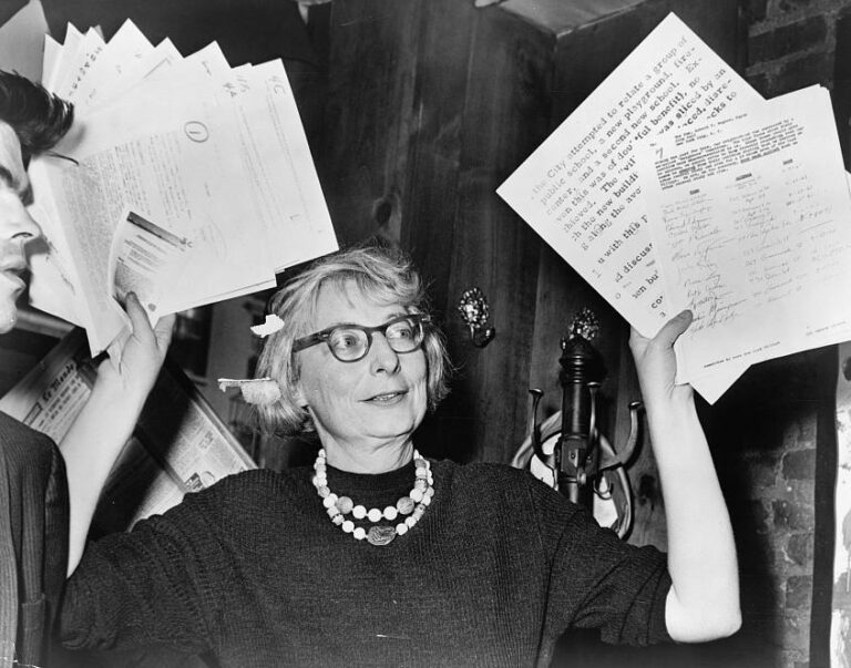
My guest this week is Sanford Ikeda, a professor of economics at SUNY Purchase and a visiting scholar at New York University. He has written extensively on urban economics, policy, and planning. Professor Ikeda introduced me to urban economics and urban planning when he gave a presentation on Jane Jacobs at a FEE summer seminar that I attended back in 2012. Here are a few of the topics we discussed in the episode: If you haven’t already, I highly suggest reading Jane Jacobs. The natural place to start is The Death and Life of Great American Cities. Her other books, including The Economy of Cities and Systems of Survival, explore topics ranging from economics to political philosophy. Professor Ikeda has written extensively on Jane Jacobs. You can read a nice overview here. If you would like to read more, click here for a paper he wrote on F.A. Hayek, Jane Jacobs, and the importance of local knowledge in cities. He is also a regular contributor to Freeman and Market Urbanism. We also discussed William H. Whyte’s famous documentary on public space, The Social Life of Small Urban Spaces. It’s well worth checking out. Help spread the word! If you are enjoying the podcast, please subscribe and rate us on your favorite podcasting platform. Find us on iTunes, PlayerFM, Pocket Casts, Stitcher, and Soundcloud. Our theme music is “Origami” by Graham Bole, hosted on the Free Music Archive.
Henry George and Jane Jacobs each have an enthusiastic following today, including, I’m sure, some readers of The Freeman. For those who might not know, Henry George is the late-19th-century American intellectual best known for his proposal of a “single tax” from which he believed the government could finance all its projects. He advocated eliminating all taxes except that on the rent of the unimproved portion of land. He viewed that rent as unjust and solely the result of general economic progress unrelated to the actions of landowners. Jane Jacobs, writing about one hundred years later, is an American intellectual best known for her harsh and incisive criticism of the heavy-handed urban planning of her day. She advised ambitious urban planners to first understand the microfoundations of urban processes — street life, social networks, entrepreneurship — before trying to impose their visions of an ideal city. Much has been written, pro and con, on George’s single tax and also on Jacobs’s battles with planners the likes of Robert Moses, and if you’re interested in those issues you can start with the links provided in this article. Here I would like to contrast their views on the nature of economic progress and the significance of cities in that progress. Some interesting parallels There are some interesting parallels between George and Jacobs. Both were public intellectuals who rebelled against mainstream economic thinking — for George it was classical economics, for Jacobs neoclassical economics. Both had a firm grasp of how markets work, were critical of crony capitalism, and concerned with the problems of “the common man.” And both established their reputations outside of academia. George was a strong advocate for free trade and an opponent of protectionism. He also understood Adam Smith’s explanation of the invisible hand. As George writes in […]
This month marks the 100th anniversary of two pieces of legislation that revolutionized the way we live. On July 11, 1916, President Woodrow Wilson signed the first Federal Aid Road Bill. And on July 25, 1916–exactly 100 years ago today–New York City passed the country’s first comprehensive zoning ordinance. Prior to 1916, transportation infrastructure was primarily a local and/or private responsibility. For example, cities leased their rights-of-way to trolley companies, which operated transit lines. Railroad companies provided travel service between cities. The 1916 Federal Road Bill was the first step in nationalizing transportation infrastructure funding, with the state highway departments formed to manage federal appropriations for roads. These two pieces of legislation produced radical change, as government favoritism of automotive infrastructure crowded out other transportation modes and undermined innovation. In the century prior to 1916, entrepreneurs invented steam ferries, trains, bicycles, trolleys, and automobiles. Such advances ceased after 1916. Yes, today’s cars are more comfortable and powerful, but they have the same steering wheel, four tires, and internal combustion engine as the Model-T Henry Ford was building 100 years ago. As for roads, the main difference is they are bigger. Unable to compete with government favored automobiles, Charleston’s last private ferry operator closed shop in 1930. Its trolley lines, which carried 20 million passengers/year (compared with CARTA’s 5 million/year) stopped running in 1937. Zoning is segregation – not only of land uses deemed incompatible, but of people deemed “undesirable.” Progressives behind New York City’s 1916 zoning ordinance regarded immigrants moving into northern cities from Europe and the South as “undesirable.” In 1921, then U.S. Secretary of Commerce Herbert Hoover tapped Edward Bassett, the leading advocate of New York City’s 1916 zoning, to create a model zoning ordinance. Engineer Morris Knowles also served on this committee. In its 1926 landmark decision in Euclid v. […]

Monday, Y-Combinator, an early-stage technology startup incubator, announced it will “study building new, better cities.” Some existing cities will get bigger and there’s important work being done by smart people to improve them. We also think it’s possible to do amazing things given a blank slate. Our goal is to design the best possible city given the constraints of existing laws. They are embarking on an undertaking of noble intentions, and I will explain why the technology sector needs to be at the forefront of thinking about cities. However, in the pursuit of designing “new” cities from a “blank slate” they have begun their quest with one fatally flawed premise, that wise technocrats can master-build entirely new cities catering to the infinitely diverse set of needs and desires of yet-to-be-identified citizens. Any visions of city-building must first humbly acknowledge that cities are an “emergent” phenomena. According to wikipedia, “emergence is a process whereby larger entities, patterns, and regularities arise through interactions among smaller or simpler entities that themselves do not exhibit such properties.” What makes cities vibrant are the “spontaneous order” which emerges among city dwellers as they pursue their individual desires. Cities are like the internet – networks, patterns, and interactions emerge not through design but from spontaneous order. Like no entity could conceivably understand or control the internet, no entity has the knowledge to anticipate the desires of millions of individual agents, and design a city accordingly. This is called the “knowledge problem.” According to economist Friedrich Hayek: If we can agree that the economic problem of society is mainly one of rapid adaptation to changes in the particular circumstances of time and place, it would seem to follow that the ultimate decisions must be left to the people who are familiar with these circumstances, who know directly of the […]

Inclusionary Zoning is an Oxymoron The term “Inclusionary Zoning” gives a nod to the fact that zoning is inherently exclusionary, but pretends to be somehow different. Given that, by definition, zoning is exclusionary, Inclusionary Zoning completely within the exclusionary paradigm is synonymous with Inclusionary Exclusion. What is Inclusionary Zoning? “Inclusionary Zoning” is a policy requiring a certain percentage of units in new developments to be affordable to certain income groups. Sometimes, this includes a slight loosening of restrictions on the overall scale of the development, but rarely enough loosening to overcome the burden of subsidizing units. Many cities, particularly the most expensive ones, have adopted Inclusionary Zoning as a strategy intended to improve housing affordability. Often, demand for below-market units are so high, one must literally win a lottery to obtain a developer-subsidized unit. Economics of Exclusion We must first acknowledge the purpose of zoning is to EXCLUDE certain people and/or businesses from an area. Zoning does this by limiting how buildings are used within a district, as well as limiting the scale of buildings . These restriction cap the supply of built real estate space in an area. As we know from microeconomics, when rising demand runs into this artificially created upward limit on supply, prices rise to make up the difference. As every district in a region competes to be more exclusive than its neighbors through the abuse of zoning, regional prices rise in the aggregate. Since the invention of the automobile, and subsequent government overspending on highways, sprawl has served as the relief valve. We’ve built out instead of up for the last several decades and this sprawl has relieved some of the pressure major metropolitan areas would have otherwise felt. In fact, it’s worked so well–and led to the abuse of zoning rules for such a long time–that exclusionary zoning has become the accepted paradigm. Zoning is the default flavor of […]