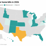
Physical Address
304 North Cardinal St.
Dorchester Center, MA 02124
Physical Address
304 North Cardinal St.
Dorchester Center, MA 02124

Liberalizing Cities
From The Ground Up
The Austin area has, for the 5th year running, been among America’s two fastest-growing major metro areas by population. Although everybody knows about the new apartments sprouting along transportation corridors like South Lamar and Burnet, much of the growth has been in our suburbs, and in suburban-style areas of the city. Our city is growing out more than up. How come? The desire for living in central Austin has never been higher. But Austin, like most cities, has rules that prevent new housing from getting centrally built. That makes it easier to buy and build on virgin land in the suburbs. Here are some of those rules. 1 MINIMUM LOT SIZE Historically, expensive houses were built on expensive, large lots; cheaper homes were built on smaller, cheaper lots. Austin decided that new houses can’t be built on small lots. Even if you want to build a small, cheap house, you still need a lot with at least 5,750 square feet. In central Austin, that costs a lot of money, even without the house! If somebody owns a 10,000 square foot lot, they aren’t allowed to split it into two 5,000 square foot lots and build two medium-sized houses, let alone three 3,333 square foot lots with three small houses, let alone three 3,333 square foot lots with triplexes! In 1999, Houston reformed its minimum lot size laws. Since then, environmentally-friendly central-city urban townhomes have flourished. 2 MINIMUM SITE AREA For areas that are zoned for apartments and condos, there is a cap on the ratio of number of apartments to lot size known as “minimum site area.” 3 IMPERVIOUS COVER MAXIMUMS Impervious cover is any surface that prevents water from seeping into the ground, including buildings, driveways, and garages. There is a cap on the ratio of impervious cover to lot size. 4 FLOOR-TO-AREA RATIO MAXIMUMS Floor-to-area ratios (aka FAR) maximums are a cap on […]
Brussels, Belgium–I had recently moved from Los Angeles, my home of twenty years, to Brussels. It would be my first time living in a traditional city since becoming interested in urban design. So I was constantly looking for little urban insights and pleasures on the ground. For instance, I immediately noticed that housing prices here are roughly half of what I encountered in Los Angeles. Within a few weeks of my arrival, the bombings of Brussels occurred. The atrocity raises some interesting questions in regards to urbanism—are there certain urban designs that can prevent or discourage terrorism? Should the threat of terrorism influence the design of our cities? How would it? While terrorism may leave us shocked and breathless, it’s worth remembering that traffic deaths greatly outnumber deaths due to terrorism. In sheer numbers of lives lost and saved, cars are the bigger culprit. Terrorism, for its part, exacts a great toll paid in fear as well as loss of life and limb. What makes a city resilient in the face of terrorism? Walking The more ways one can move about the city, the more resilient it will be in the face of crisis. But, these options are not equal; cars are big compared to the space available for them—if everyone were to drive, no one would move. Here, man in his humblest form is king—we are always ready to walk, several miles if need be, without the aid of any special operator or infrastructure. Density and proximity ensure walking home is a reasonable or even routine affair. Walking loses its appeal, however, as travel distances increase, especially for the less physically able among us. And as much as walkability is ideal, many cities are just not suited for it, in their current state. Work is too far to reach via […]

A recent trip to the tax attorney’s office put me in close proximity to a fellow client as we waited. This guy was one of the lead developers of autonomous vehicles so I picked his brain for a while. He said his company is on track to have products on the road in four or five years. Here’s a little heads up for those of you who think you know how driver-less cars will play out in the culture and economy. The first commercial adopters of this technology (other than the military) will be fleets of long haul trucks. The big box retailers have already calculated the savings on labor and fuel efficiency as well as just-in-time delivery optimization with vehicles that aren’t burdened by humans. . Uber and other taxi services have already announced their desire to convert to driverless cars in an attempt to improve service and lower costs. Car sharing services may convert to the on demand driverless taxi model as well. The U-Haul folks will eventually morph with the storage pod pick up and delivery services that are already in operation. Municipal governments hemorrhaging cash for salaries, health insurance, and pension costs will find it irresistible to phase out humans for sanitation vehicles. When I was a kid there were three men (and they were, in fact, always men) on each truck. Today there’s one person with a video camera and a robotic arm collecting the trash. Soon the truck and the robot arm won’t need a human at all. We can expect the same trajectory for mail carriers, utility meter readers, and other such activities. City buses will eventually see the end of human drivers, particularly as dedicated bus lanes and BRT come to dominate the surviving transit systems. In many suburban locations public buses may […]
When laypeople hear the phrase “rent control”, they typically conjure up one of a few images. Tenants imagine easy street, a world where housing is ridiculously low cost. Maybe they think of rent control in NYC, where they saw the characters from Friends live in large apartments for far below market value. Landlords think of reduced profits, and tenants who live in a unit for years on end, never paying market value. Economists on both the left and right, meanwhile, simply picture bad policy. A prime example is Thomas Sowell, a world-renowned economist who claims both tenants and landlords suffer from rent control. He discusses the economics of rent control in his book Basic Economics, and his arguments have been summarized here. With Rent Control Comes a Greater Demand for Housing In an uncontrolled market, prices vary with the amount of demand. That is, prices rise because the amount of a product that people want exceeds the amount that is available at current prices. Put simply, more people want an item than there are items to go around, so to get that item you go into an indirect bidding process with other buyers. Imagine a fellow named Jerry and a girl named Elaine. Jerry wants a one-bedroom apartment in San Diego, but he can only afford $850 a month in rent. Elaine also wants to find a one-bedroom apartment, but she can afford $1,500 a month. Because there is currently a free market in San Diego, Jerry can’t find a one-bedroom for $850. There are a limited number of units and there are many more “Elaines” who are also willing to pay $1,500, which means rents hover around that value. As a result, Jerry reluctantly rents a 3-bedroom apartment with two roommates. Elaine finds a one-bedroom one at market price. […]
1. This week at Market Urbanism: Michael Lewyn published his second MU article, Vouchers, Sprawl and Trade-Offs discussing the challenges to mitigating the “sprawl-generating machine” of the US public education system A more market-oriented solution to the problem of sprawl-generating school systems is to break the link between residence and schooling, so that city residents would not be limited to urban neighborhood public schools. Emily Washington‘s follow-up post about the need for low-quality housing. I can’t emphasize enough, the importance of Emily’s argument! But government housing has a long, broad, and universal history of decrepit living conditions, poor safety, and negative economic mobility. Indeed, a welfare state large enough to provide housing support to millions of immigrants would have drastically increased voter-opposition to the United States’ relatively open doors. 2. Where’s Scott? Scott Beyer spent his first week in Dallas, locating in the rapidly-growing northern suburb of Richardson. His two Forbes articles were about Oklahoma City—A Tale Of Two Alcohol Laws: New Orleans And Oklahoma City and How Tinder Is Changing The Urban Bar Scene: One competing Oklahoma City bar had, according to Cole and Koinzan, put a sign out front saying “come have your awkward Tinder date here.” If other bars nationwide are noticing such cultural shifts, perhaps they should hang these signs too. 3. At the Market Urbanism Facebook Group: Adam Milsap shared his article Help Distressed People, Not Distressed Cities Tobias Cassandra Holbrook shared People Prefer Neo-Traditional Buildings Bjorn Swenson is interested in development pattern in Houston John Morris looked at all the land use micro-management, and isn’t buying the gobblygook that Houston isn’t zoned David N Welton wants to see thorough rebuttals of the “the character of the neighborhood” NIMBY argument Three people shared an MIT Technology Review article on how data mining is backing up Jane Jacobs on the four conditions that make vibrant urban neighborhoods 4. Elsewhere: R.I.P. Zaha Hadid. A look back […]
Browsing through peoples’ posts of their favorite things to do in Houston, there’s a recurring theme of eating out. USA Today called Houston “the dining-out capital of the nation”: on average, we eat out more often than any other city in the country, at the second-lowest average price (Zagat). The Chronicle claims Houstonians eat out a third more times per week at 20 percent lower cost than the national average, with 9,000 area restaurants to choose from (which also makes us one of the nation’s leaders in restaurants per capita). Finally, I’ve talked to tons of people who have moved away from Houston, and one of the first things they mention missing is the restaurants. So it’s definitely one of the great strengths of Houston, but also one that raises skepticism from anybody who hasn’t lived here: why would Houston have more or better restaurants than anywhere else? What’s so special about Houston? I think there are set of factors that have come together to create the “perfect storm” of great restaurants in Houston: Diversity. Start with Houston having a very diverse population from all over the globe, so there’s plenty of people available to start restaurants in their native ethnic cuisine. Not a whole lot of cities can say that. I think a lot of that is related to being the capital of the energy industry, which is an inherently global industry. That plus being a major port city and proximity to Latin America and Cajun Louisiana. Lack of zoning. Houston’s open development culture makes it easy for anybody to start a restaurant. Plenty of inexpensive space and not a lot of regulations/permitting. The freeway network. This may seem to be an odd factor, but think about it. We have a very well developed freeway network compared to […]
Last week I wrote a post highlighting how important it is for major cities to have places for low-income people to live. Without the opportunity to live in vibrant, growing cities, our nation’s poor can’t take advantage of the employment and educational opportunities cities offer. My post offended some people who don’t think that reforming quality standards is a necessary part of affordable housing policy. On Twitter @AlJavieera said that my suggestion that people should have the option to live in housing lacking basic amenities is “horribly conservative.” Multiple people said that my account of tenement housing was “ahistorical.” They didn’t elaborate on what they meant, but they seemed to think I was suggesting that tenements were pleasant places to live, or that people today would live in Victorian apartments if such homes were legalized. On the contrary, I argue that in their time, tenements provided a stepping stone for poor immigrants to improve their lives, and that stepping stone housing should be legal today. Historical trends provide evidence that people born into New York’s worst housing moved onto better jobs and housing over time. The Lower East Side tenements were first home to predominantly German and Irish immigrants, and later Italian and Eastern European Jewish immigrants. The waves of ethnicities that dominated these apartments indicate that the earlier immigrants were able to move out of this lowest rung of housing. The Tenement Museum provides multiple oral histories of people who were born into their apartment building and went on to live middle-class lives. In The Power Broker, Robert Caro provides an account of one community that had moved out of the Lower East Side to better housing in the Bronx: The people of East Tremont did not have much. Refugees or the children of refugees from the little shtetles in the Pale of Settlement and from the ghettos of Eastern Europe, the Jews who at […]
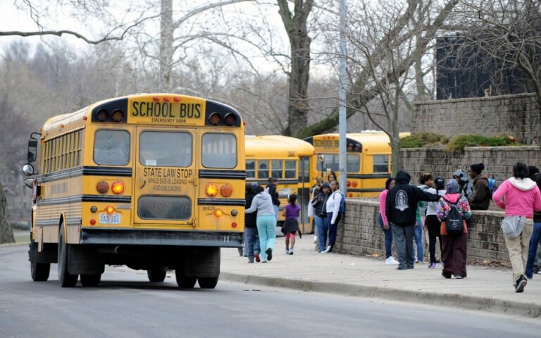
Currently, the American public school system is a sprawl-generating machine: urban public schools are less appealing to middle-class parents than suburban public schools, causing parents to move to suburbia. This result arises from school assignment laws: because students must attend school in the municipality of their residence, residents of the most diverse municipalities (usually central cities) must attend diverse schools. By definition, diverse schools have lots of children from disadvantaged backgrounds. Because children from disadvantaged backgrounds often learn less rapidly than middle-class children, these schools quickly get a reputation as “bad” schools, causing middle-class parents to flee to suburban schools that are more socially homogenous. The common progressive answer to this problem is to fund urban schools more generously: this strategy has not, when tried, succeeded in bringing middle-class parents back to urban schools. For example, in 1990s Kansas City, federal courts forced government to fund urban schools far more generously than suburban schools: nevertheless, test scores barely budged and urban schools continued to lose middle-class and white parents. Even successful urban charter schools (such as New York’s Harlem Success Academy) have failed to bring back middle-class parents. A more market-oriented solution to the problem of sprawl-generating school systems is to break the link between residence and schooling, so that city residents would not be limited to urban neighborhood public schools. One possible option is some form of a voucher system. Under the purest form of a voucher system, parents who choose to avoid public schools would be given public funds to pay the cost of private schools. Under such a system, parents would have little reason to avoid city neighborhoods: they could stay in the city, and their children could attend private schools for the same amount of money that they would spend on public schools (that is, zero). Such voucher systems […]
1. This week at Market Urbanism: Emily Washington described The Need For Low-Quality Housing in America’s most desirable cities. People of very little means could afford to live in cities with the highest housing demand because they lived in boarding houses, residential hotels, and low-quality apartments, most of which are illegal today. Making housing affordable again requires not only permitting construction of more new units, but also allowing existing housing to be used in ways that are illegal under today’s codes. Adam Hengels posted part 7 in his long dormant Rothbard the Urbanist series Tragically, Rothbard’s insights on these subjects have been mostly neglected for over 30 years, while apologists for sprawl and automobile dominance have nearly monopolized the conversation among free-market advocates. 2. At the Market Urbanism Facebook Group: Naor Deleanu updated us on San Diego‘s stadium subsidy proposal Mark Frazier shares the pros and cons of a privately-run city in India Nolan Gray: Classic New York Streetscapes, Then and Now Interesting what changed and what hasn’t Anthony Ling shared an invite to a conference at NYU. Success Without Design: Lessons from the Unplanned World of Development 3. Elsewhere: Highways gutted American cities. So why did they build them? Stephen Eide makes the case for states taking back control from mismanaged cities. An interview with the author of “Evicted:” a story of “eight peripatetic families in Milwaukee — and two landlords” How Chicago racked up a $662M police misconduct bill …not to be outdone, Chicago’s teachers’ union may strike again 4. Stephen Smith‘s Tweet of the Week: “Housing is a human right,” says the group founded for the sole purpose of preventing new housing from being built https://t.co/mvpBmDda1R — Market Urbanism (@MarketUrbanism) March 19, 2016
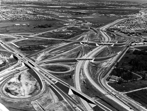
Surprise!! I’ve had the intent to wrap-up the Rothbard The Urbanist series for a long time, and it’s been sitting on my todo list for over 6 years. I want to thank Jeffrey Tucker, then at mises.org, and now at FEE.org and liberty.me for enthusiastically granting permission to reprint excerpts from For A New Liberty. Murray Rothbard’s 1973 classic can be downloaded free from Mises.org as pdf, and audio book read by Jeff Riggenbach. This chapter is also discussed by Bryan Caplan as part of an econlog book club series on For A New Liberty. It’s been a while, so you may want to catch up on the first six posts: Rothbard the Urbanist Part 1: Public Education’s Role in Sprawl and Exclusion Rothbard the Urbanist Part 2: Safe Streets Rothbard the Urbanist Part 3: Prevention of Blockades Rothbard the Urbanist Part 4: Policing Rothbard the Urbanist Part 5: Diversity and Discrimination Rothbard The Urbanist Part 6: Traffic Control We pick up in the heart of chapter 11: “The Public Sector, II: Streets and Roads” to expand on a subject core to Market Urbanism: the pricing of highways, and the consequences of a system where politics, special interests, and top-down planning have incarnated a dysfunctional system severely disconnected with bottom-up pricing signals necessary to be sustainable. Tragically, Rothbard’s insights on these subjects have been mostly neglected for over 30 years, while apologists for sprawl and automobile dominance have nearly monopolized the conversation among free-market advocates. We begin the section with Professor Rothbard’s acknowledgement of what sprawl apologists turn a blind eye to, yet urbanists on the left are keenly aware. Government intervention, fueled by special interests and old-fashioned progressive ideology, massively subsidized the highway system and crowded-out otherwise viable railroads. As a result, we have an overbuilt highway system, urban neighborhoods were eviscerated, suburbs spread far-and-wide, privately […]