Physical Address
304 North Cardinal St.
Dorchester Center, MA 02124
Physical Address
304 North Cardinal St.
Dorchester Center, MA 02124

Liberalizing Cities
From The Ground Up
Surprise!! I’ve had the intent to wrap-up the Rothbard The Urbanist series for a long time, and it’s been sitting on my todo list for over 6 years. I want to thank Jeffrey Tucker, then at mises.org, and now at FEE.org and liberty.me for enthusiastically granting permission to reprint excerpts from For A New Liberty. Murray Rothbard’s 1973 classic can be downloaded free from Mises.org as pdf, and audio book read by Jeff Riggenbach. This chapter is also discussed by Bryan Caplan as part of an econlog book club series on For A New Liberty. It’s been a while, so you may want to catch up on the first six posts: Rothbard the Urbanist Part 1: Public Education’s Role in Sprawl and Exclusion Rothbard the Urbanist Part 2: Safe Streets Rothbard the Urbanist Part 3: Prevention of Blockades Rothbard the Urbanist Part 4: Policing Rothbard the Urbanist Part 5: Diversity and Discrimination Rothbard The Urbanist Part 6: Traffic Control We pick up in the heart of chapter 11: “The Public Sector, II: Streets and Roads” to expand on a subject core to Market Urbanism: the pricing of highways, and the consequences of a system where politics, special interests, and top-down planning have incarnated a dysfunctional system severely disconnected with bottom-up pricing signals necessary to be sustainable. Tragically, Rothbard’s insights on these subjects have been mostly neglected for over 30 years, while apologists for sprawl and automobile dominance have nearly monopolized the conversation among free-market advocates. We begin the section with Professor Rothbard’s acknowledgement of what sprawl apologists turn a blind eye to, yet urbanists on the left are keenly aware. Government intervention, fueled by special interests and old-fashioned progressive ideology, massively subsidized the highway system and crowded-out otherwise viable railroads. As a result, we have an overbuilt highway system, urban neighborhoods were eviscerated, suburbs spread far-and-wide, privately […]
Both Vermont Senator Bernie Sanders and New York reality television personality Donald Trump have based their presidential campaigns in part on the issue of trade. Both of them oppose free trade policies like the North American Free Trade Agreement and the pending Tran Pacific Partnership, arguing that free trade has resulted in American jobs going overseas, leaving American workers worse-off. To remedy this situation, Trump has proposed declaring China a currency manipulator and imposing duties on Chinese-made goods, while elsewhere he’s advocated a 35 percent import tax on items made in Mexico and a 20 percent tax on all other imported goods. Sanders has also advocated imposing tarrifs on countries that manipulate their currencies to subsidize exports. To counter both candidates’ narratives of heartless corporations offshoring American jobs or unscrupulous foreigners “stealing” jobs that belong to American workers, economists and commentators from across the political spectrum have compiled impressive arrays of statistics proving that free trade actually benefits everyone. But they didn’t have to do so much. There are already examples, right now, of protectionist legislation that explodes the myths of the Trump and Sanders crowds. Since 1978, the “Buy America” provision of the Surface Transportation Assistance Act has forced transit agencies and passenger railroads like Amtrak and commuter rail services to have around 60 percent of the equipment and structural components manufactured in the United States if they want federal funding for their projects, unless they apply for and receive a waiver. Has this provision protected American workers? Does the United States now have a thriving rail equipment industry capable of competing with European, Japanese and Chinese companies, bearing out Alexander Hamilton’s “infant industry” argument? No. According to Metro Magazine, the Buy America provision makes “significant supply-chain disruptions” likely because the American market share for bus and train components […]

Cities, for most of human history, were dumb. At least, that’s what the “smart cities” movement might lead you to believe. Over the past few years, a chorus of acquisitive multinational tech corporations, trend-savvy politicians, and optimistic developers—an odd mixture of former SimCity players, in all likelihood—has come to sing of technology’s potential to solve urban problems. Through implementation of technologies like augmented physical infrastructure, central command centers, and information exchange, proponents of smart cities argue that information technology offers new solutions to old problems like trash collection, public health, and traffic congestion. While the movement’s ideological variations are many and varied, a focus on top-down smart city solutions has ultimately distracted urban observers from the bottom-up smart city revolution that’s already underway. In his 2014 book Smart Cities: Big Data, Civic Hackers, and the Quest for a New Utopia, scholar Anthony M. Townsend paints a troubling picture of the former in Rio de Janeiro’s modestly titled Center for Intelligent Operations. Developed by IBM, the center acts as a hub for hundreds of surveillance cameras and sensors. At best, the center achieves little more than, in Townsend’s words, “looking smart.” At worst, the center seems to be a regression back to twentieth century centralization. Townsend’s explorations of Songdo, South Korea, a city purported to be both centrally-planned and smart, hardly quells these concerns. The discussion leaves the reader with a healthy skepticism of top-down smart city solutions. Other criticisms have made the top-down smart city feel less like something out of 1984 and more like something out of Terry Gilliam’s Brazil. In a couple of recent posts, Emily points out the roadblocks presented by poor incentives and a lack of market signals, both for politicians and high-ranking public servants. For similar reasons, both parties lack the incentives to implement […]
Public transportation service provision is changing. As I already have mentioned in this post at Caos Planejado, microtransit services are growing in many cities around the world and one of the forefront companies on this field is Bridj, operating in Boston since June 2014 and Washington DC since May 2015. I had the opportunity to interview David Block-Schachter, Chief Scientist of Bridj at Bridj’s office in Boston last October. Check it out: Marcos Paulo Schlickmann: Could you tell a little about yourself and your inspiration to work in this field? David Block-Schachter: About 8 years after finishing my bachelor’s I went back to school to do a PhD in transportation at MIT. After the PhD I worked for the MBTA as their Director of Research and Analysis to understand how they can use their data to improve operations. After that I joined Bridj. We wanted to improve mass transit generally, and looked at the issues here in Boston as our first focus. And obviously my background helped too. We also looked at informal transit systems all around the world. When I went to Rio I noticed how the buses are at a disadvantage, because the traffic itself is so unreliable that if you have a car you would prefer to be stuck on traffic in your car than in the bus. So we asked ourselves: “How can we use technology to combine the direct service associated with small vehicles with the good level of service we see in mass transit systems in America and Europe without inheriting the defaults and drawbacks of each system?” And the main advantage of direct trips instead of changing vehicles can be addressed by technology. MPS: As we see on the map depicting Bridj’s service areas, the company runs buses in 3 main areas with two main lines: Allston/Coolidge […]
In political transactions, players cannot make deals using dollars, but nonetheless they engage in trades to pursue their goals. Policymakers may engage in trades both with other policymakers and with private sector actors . While these deals are not denominated in dollars, their gains from trade can still be considered “profit” that goes to the parties to the trade. In the decision to create the DC Metro’s silver line extending from West Falls Church to Dulles International Airport, many public sector and private sector parties profited from the complex dealmaking that facilitated the extension. The Silver Line was accompanied by redevelopment planning for Tysons Corner, a suburb of DC along the line’s route. These rail construction and accompanying rezoning benefitted three primary groups. The first and most obvious beneficiaries of the development of the Silver Line were the individuals and corporations that owned large parcels of land near the planned stations. The value of their holdings increased not only because of the new infrastructure, but also because the planning for the Silver Line involved significant upzoning, making more intensive and profitable use of their land legal. The combined promise of upzoning and the new metro stations ensured local policymakers that powerful landowners would support their efforts. These large landowners who benefited from upzoning include West Group, Tysons Corner Property, and West Mac Associates among other. The leadership members of these corporations were active in commenting on the proposed changes to the area’s land use and transportation plans. Because of its large investment in Tysons Corner and its corresponding importance in the development process, West Group has had special involvement in the redevelopment process. Implementing the proposed grid of streets relies heavily on West Group properties and other major developers cooperating to minimize the need to use eminent domain to achieve the infrastructure requirements to facilitate increased […]
Over at FiveThirtyEight, Nate Silver and Rueben Fischer-Baum claim mass transit is Uber’s best friend. They use data from New York to show that Uber is most frequently used in areas with effective mass transit. They explain that residents in areas with poor access to mass transit are more likely to assume the fixed cost of car ownership. Once that overhead has been assumed, these residents are more likely to use the personal vehicle they’re already paying for rather than rely on alternative modes of transportation. There’s variation in use depending on the intersection of income level and transit accessibility, but that the big takeaway is that mass transit supports Uber. And that Uber as well as other TNCs will be most successful where effective mass transit is already in place. It’s a great analysis. And it’s partially right–but not entirely. Mass transit does support TNC growth just as the authors describe. But TNCs, in turn, support mass transit by solving the last mile problem. The two systems are complementary. But without a supportive urban environment, neither system stands any chance of success. Mass transit and TNCs may be allies, but both rely on urban density as their benefactor. Residents in densely developed cities with mixed land use consume less transportation per capita because the distances between work, housing, and recreation are all much shorter. And below a certain level of consumption, the minimum fixed cost of car ownership ceases to make sense. Alternative forms of transportation like a mass transit system or a TNC platform entail only marginal cost, so they begin to look more attractive. Imagine putting a mass transit system–commuter rail, BRT, whatever you’d like–in the middle of Houston or LA style sprawl. It might be a net positive for a TNC, but in no way […]
The similarities of urban design across American neighborhoods is no coincidence, but neither is it the result of city planners’ uniform adherence to best practices. Infrastructure is often built based on shockingly little information about the demands of its users. And while poorly reasoned infrastructure policy in one city is bad enough, the United States’ broad adherence to poorly reasoned policies has resulted in a nation in which swaths of neighborhoods are built on poor design foundations. Parking Requirements In The High Cost of Free Parking, Donald Shoup explains the origin of municipal parking requirements. Municipal planning offices do not have the resources to study the amount of parking that businesses should provide. Even with more staff, it’s not clear that planners would be able to determine optimal parking requirements unless they allowed business owners themselves to experiment and choose the amount of parking on their own in a learning process of how to best serve their customers. The Institute of Transportation Engineers is one of the only organizations that provides estimates of the number car trips that businesses generate. Given the lack of information planners have to determine parking requirements, they often rely on ITE’s information to set their parking requirements. However, ITE studies are often conducted at businesses that already provide ample free parking, ignoring the potential for businesses to manage demand for parking on their property through prices. Furthermore, ITE estimates of trip generation are typically based on a very small sample of locations, which are unlikely to be representative of businesses and cities in general. In the example below, the ITE provides a recommendation for fast food parking requirements based on their floor area. Even though the chart includes a line of best fit for the plot of peak parking spot occupation and floor area, the ITE hasn’t demonstrated a correlation between these two variables. Shoup points out: We cannot say much about how […]

Alain Bertaud is probably the most interesting urbanist you’ve haven’t heard about. He is a senior researcher at the NYU Stern Urbanization Project next to names such as Paul Romer and Solly Angel. Bertaud used to be the lead urbanist at the World Bank, and Ed Glaeser has said that everything he knows about land use restrictions in developing countries he has learned from Alain. Bertaud has also worked as a consultant and/or resident urbanist in cities such as Bangkok, San Salvador, Port-au-Prince, Sana’a, New York, Paris, Tlemcen and Chandigarh. Our Brazilian collaborator Anthony Ling, editor of Caos Planejado, met Bertaud at the NYU DRI conference last year entitled “Cities and Development: Urban Determinants of Success”, who gave us the following interview: AL: You are currently writing a book tentatively titled “Order Without Design”, which in some way relates to the title of our website, “Planned Chaos”. What do you mean by the title of your next book – what should readers expect of it? AB: “Order without design” is a quotation from Hayek that he uses in a different context in “The Fatal Conceit”: “Order generated without design can far outstrip plans men consciously contrive”. In the context of cities it means that cities themselves are mostly self generated by simple rules and norms applied to immediate neighbors but with overall design concept designed by one person or a group of designers. The spatial structure of large cities is a mix of top-down design and spontaneous order created by markets. Spontaneous order appears in the absence of a designer’s intervention when markets and norms regulate relationships between immediate neighbors. Most evolving natural structures, from coral reefs to starlings’ swarms, are created by spontaneous order. The objective of my book is to show that top-down design should be reduced to a minimum and much more room should […]
Last week, Nick Josefowitz unseated a multi-decade incumbent for a spot on the BART board of directors. Normally I don’t pay too much attention to elections, but Mr. Josefowitz might actually have some good ideas. For everyone outside the Bay Area, the BART (Bay Area Rapid Transit) system is a commuter rail line that constitutes the vital transportation link between the East Bay and San Francisco. On a typical weekday it provides 400,000 rides and that number is increasing as the regional economy continues to boom. Suffice it to say that BART is a big deal to a lot of people who rely on it every day (myself included). While Josefowitz’s campaign website talks about cleaning up dirty stations and increasing late night train availability, I had the privilege of hearing him outline an interesting proposal during a private, small group discussion some months ago. According to Josefowitz, BART sits on a substantial amount of real estate in the form of station parking lots. His proposal was to repurpose some of this space as high density housing. This would help with the region’s housing shortage and support BART ridership by clustering population around the system’s stations and the lost spots could be offset by building parking structures on the remaining lot space (many BART parking lots are ground level only as opposed to multi-level parking structures). This sounded a lot like Hong Kong’s integrated rail-property development approach which has proven to be an unqualified success, so my interest was definitely piqued. As always, there’s plenty of which to be skeptical. The fact that the proposal was brought up in a private discussion, but isn’t listed on the campaign website may say something about where it falls in Josefowitz’s priorities. Also, it’s difficult to tell how effective the incoming director will be […]
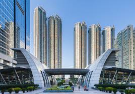
Integrating rail and property development is the cornerstone of the MTR’s success. In the U.S., coordination between transit authorities and developers tends to be mediocre at best. In Hong Kong, however, the MTR is both the transit authority as well as the property owner, and this makes all the difference. Coordination Problem Most attempts at transit-oriented development in the U.S. involve multi-party negotiations. The agency responsible for the transportation system haggles with different developers interested in undertaking projects along the line. Instead of implementing a unified plan, the transit agency has to negotiate specific agreements with each developer. And, because the priorities of the transit agency and the developers are never perfectly aligned, development agreements become subject to second-best compromises. Further, any disputes that arise once significant capital has been committed are costly to resolve. This arrangement makes leveraging land values difficult as well. Developers frequently get tax breaks as an incentive to undertake projects. Whether abatements on property tax or straight-forward rate reductions, tax incentives typically preclude the use of land values to help fund transit. And, even without special incentives, major property owners who stand to benefit from proximity to a transit system have every reason to resist tax increases of any kind if there’s a chance of free-riding. The MTR, on the other hand, uses the integrated rail-property development approach which combines the two roles of landlord and transit developer. The MTR owns the right-of-way as well as the surrounding properties. This removes the necessity of extended negotiations, having to settle for second best solutions, and the potential downside of disagreements partway through a project. By combining the functions of landlord and transit developer, the MTR is also able to internalize land values. The rail line drives up the value of the MTR’s properties and that value covers […]