Physical Address
304 North Cardinal St.
Dorchester Center, MA 02124
Physical Address
304 North Cardinal St.
Dorchester Center, MA 02124

Liberalizing Cities
From The Ground Up
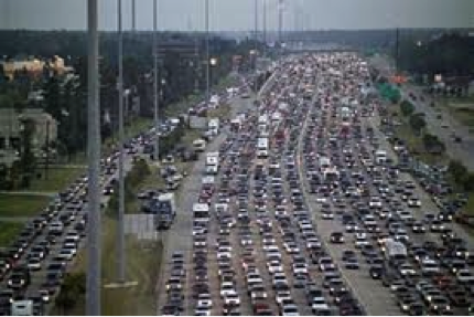
Every so often I read something like the following exchange: “City defender: if cities were more compact and walkable, people wouldn’t have to spend hours commuting in their cars and would have more free time. Suburb defender: but isn’t it true that in New York City, the city with the most public transit in the U.S., people have really long commute times because public transit takes longer?” But a recent report may support the “city defender” side of the argument. Replica HQ, a new company focused on data provision, calculated per capita travel time for residents of the fifty largest metropolitan areas. NYC came in with the lowest amount of travel time, at 88.3 minutes per day. The other metros with under 100 minutes of travel per day were car-dependent but relatively dense Western metros like Los Angeles, Las Vegas, Salt Lake City and San Jose (as well as Buffalo, New Orleans and Miami). By contrast, sprawling, car-dependent Nashville was No. 1 at 140 minutes per day, followed by Birmingham, Charlotte and Atlanta. * How does this square with Census data showing that the latter metros have shorter commute times than New York? First, the Replica data focuses on overall travel time- so if you have a long commute but are able to shop close to home, you might spend less overall time traveling than a Nashville commuter who drives all over the region to shop. Second, the Replica data is per resident rather than per commuter- so if retirees and students travel less in the denser metros, this fact would be reflected in the Replica data but not Census data. *The methodology behind Replica’s estimates can be found here.
New York City is an epicenter of the global novel coronavirus pandemic. Through April 16, there were 1,458 confirmed cases per 100,000 residents in New York City. Always in the media eye, and larger than any other American city, New York City has become the symbol of the crisis, even as suburban counties nearby suffer higher rates of infection. In a paper dated April 13, 2020, Jeffrey E. Harris of M.I.T. claims that “New York City’s multitentacled subway system was a major disseminator – if not the principal transmission vehicle – of coronavirus infection during the initial takeoff of the massive epidemic.” Oddly, he does not go on to offer evidence in support of this claim in his paper. Conversely, as I will show, data show that local infections were negatively correlated with subway use, even when controlling for demographic data. Although this correlation study does not establish causation, it more reliably characterizes the spread of the virus than the intuitions and visual inspections that Harris relies on. Data In an ongoing crisis with a shortage of tests, all infection and mortality data come with a major asterisk: we do not fully know the extent of the data. Only when all-cause mortality data and more-extensive testing data are available can any conclusions be confirmed. This study, like Harris’ and others, is subject to potentially massive measurement error. Data from the American Community Survey (2018 5-year averages) show that commuting modes vary extensively across New York City. New York is broken into Community Districts (CDs), which generally correspond (on either a one-to-one or two-to-one basis) with Census Public Use Microdata Areas (PUMAs). These 55 areas contain between 110,000 and 241,000 people each. The most car-dependent PUMA (Staten Island CD3) has a car-commute share of 75%; the least car-dependent PUMA is Manhattan […]
In this interview I talk to Onésimo Flores, Founder of Jetty, a (sort-of) microtransit company from Mexico City. Marcos Schlickmann: Thank you for participating in this interview. Please introduce yourself and talk a little bit about how Jetty came to life and what is your idea behind this project. Onésimo Flores: I’m Onésimo Flores, the founder of Jetty. I have a PhD in urban planning from MIT and a master’s in public policy from Harvard. I graduated in Law from the Universidad Iberoamericana, Mexico. The idea of Jetty came about by contrasting a conflicting approach to regulation in public transportation in a place like Mexico. On one end of the spectrum, a you have a very tightly-regulated, low-quality, scarce public transport service, most of it operated by private, informal, artisanal, minibus operators, and on the other hand, ride-hailing apps, taxi apps, that had emerged not only Uber but several others, that enjoy a lot of regulatory leeway in terms of freedom to set their fares, to operate anywhere, to open the market to private individuals with spare time and spare vehicles. So, in that context, the hypothesis was that, in a way applications like Uber have made it possible to standardize a level of service: people can know what to expect, know that somebody will be held accountable if something goes wrong, know the basics of the trip, the fare and the rated quality of the driver. The level of information the passengers will get is standardized no matter who the supplier of the services is. So, the hypothesis in Jetty is that we can do something similar for collective transportation without relinquishing the economies of scale of using larger vehicles, but we do give the public access to the service improvements made possible by technology. MS: Talk a little […]

On June 24 in Brooklyn, a driver in an SUV struck and killed four-year-old Luz Gonzalez, with many onlookers claiming the incident was a hit-and-run. The New York Police Department disagrees, and has refused to prosecute the driver, sparking multiple street protests. Beyond seeking justice for Gonzalez, activists demand that the city expand the use of speed cameras in school zones, which they hope could prevent further tragedy. Yet precisely at the moment that the community is most sensitive to the risk that dangerous driving poses to children, the New York state legislature shut off 140 school zone speed cameras. Given their unambiguous success in improving traffic safety in school zones, legislators should act now to renew and expand the program. While there is rare consensus among Governor Andrew Cuomo and Mayor Bill de Blasio on the need to preserve and even expand the traffic camera program to 290 cameras, the expansion faces opposition from some members in the Senate. Opposition to the cameras has been lead by Republican State Senator Martin J. Golden—himself a notorious school zone speeder, having received over 10 tickets since 2015 alone—and Democrat State Senator Simcha Felder, who ineffectively used the cameras as a bargaining chip to install police officers in schools. Since their implementation in 2014 as part of the broader Vision Zero initiative, school zone speed cameras have already substantially improved pedestrian safety in New York’s school zones. According to one study by the New York City Department of Transportation, the number of people killed or seriously injured in crashes in schools zones has fallen by 21 percent to 142 since the cameras came online. This is due in part to the fact that speeding drivers are getting the message: in the first 14 months following implementation of cameras, speeding violations in school […]

There’s been an ongoing debate in urbanist circles about whether autonomous vehicles (AVs) will damn us to perpetual sprawl and super commuting. I don’t believe that they will. In the first place, the business conditions under which AVs could conceivably induce more sprawl are unlikely. And in the second, there are numerous other factors that will affect the future of urban development in the US. That’s not to say we won’t double down on past mistakes, but it won’t be AVs that single handedly bring about that future on their own. No One Wants To Sell You a Self Driving Car For AVs to even begin to induce more sprawl, they need to facilitate super commuting. For that to happen at any significant scale, they need to be ubiquitous and privately owned. And that is something I don’t think we’re going to see for one simple reason — it’s a product no one is selling. Ole Muskie notwithstanding, no one with capital to burn thinks selling private AVs is a winning strategy (with good reason). Given the accumulated R&D costs of the last several years, the price a firm would need to charge for the first generation of personal AVs would be astronomical. Moreover, a company selling personal AVs would give up on mountains of valuable data generated as the vehicle racked up mileage. Trip data feeds back in to improving the ability of AVs to navigate and data about consumer habits is valuable as well. We should also remember that the state of AV technology is still quite…meh. And in the absence of a step function improvement in the technology, the fastest way to get to market is to restrict the problem space. That means means a driverless TNC service that can be limited to trips in certain areas […]
Suburb: Planning Politics and the Public Interest is a scholarly book about planning politics in Montgomery County, a (mostly) affluent suburb of Washington, D.C. The book contains chapters on redevelopment of inner ring, transit-friendly areas such as Friendship Heights and Silver Spring, but also discusses outer suburbs and the county’s agricultural areas. From my perspective, the most interesting section of the book was the chapter on Friendship Heights and Bethesda, two inner-ring areas near subway stops. When landowners proposed to redevelop these areas, the planning staff actually downzoned them (p. 56)- and NIMBYs fought the planning board, arguing that even more downzoning was necessary to prevent unwelcome development. These downzoning decisions were based on the staff’s “transportation capacity analysis”- the idea that an area’s roads can only support X feet of additional development. For example, Hanson writes that Friendship Heights “could support only 1.6 million square feet of additional development.” (p. 62). Similarly, he writes that Bethesda’s “roads and transit could handle only 12 million square feet of new development at an acceptable level of service.” (p. 75) Thus, planning staff artificially limited development based on “level of service “(LOS) . “Level of service” is a concept used to grade automobile traffic; where traffic is free-flowing the LOS is A. But the idea that development is inappropriate in low-LOS places seems a bit inconsistent with my experience. Bethesda and Friendship Heights zip codes have about 5000-10,000 people per square mile; many places with far more density seem to function adequately. For example, Kew Gardens Hills in central Queens has 27,000 people per square mile, relies on bus service, and yet seems to be a moderately popular area. Moreover, the use of LOS to cap density has a variety of other negative effects. First, places with free-flowing traffic tend to be dangerous for […]
During an urbanist twitter free-for-all last week, the thoroughly awesome term “liberty machines” was used to describe the virtues of the car. The claim was made that cars let individuals go wherever they want, whenever they want and are therefore a ‘freedom enhancing’ form of transit. This isn’t the first time I’ve heard this argument in libertarian(ish) circles. But it doesn’t tally with my experience and I’m not sure it makes any sense even within its own premise. A Personal Anecdote and a Couple Thoughts When I learned to drive way back when, it was in the great state of Texas where driving is basically a necessity. In that context, getting my license (and being economically fortunate enough to have access to a car) was certainly liberating for me after a fashion. Thinking back, though, I enjoyed far less mobility as a car bound teenager in suburban Houston than I do now living in Oakland, California. I walk to the grocery, take BART to work, bike to the gym, catch a Lyft to go out, and/or drive myself when the occasion demands. Most of my trips are multimodal and the integration of transit modes affords me far more freedom of movement than car use alone ever could. The biggest reason for this is that single occupancy vehicle use doesn’t scale as a stand alone system. Unpriced roadways are prone to hitting congestion points and, as readers of this blog are probably aware, adding lanes doesn’t help. When roads become clogged, and there are no viable alternatives, a reliance on cars becomes a constraint. And to respond to the idea that mass transit relies on government subsidies and car use does not…the technical term for that would be factually incorrect. Mass transit is more than capable of paying for itself and let’s just say highways don’t […]
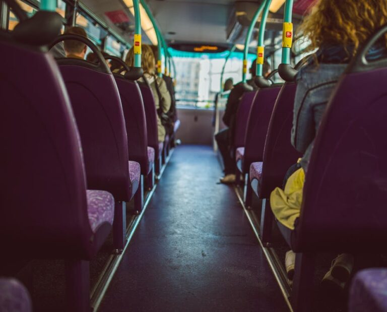
At 4:30 am, alarms on my cellphone and tablet start beeping, just enough out of sync to prompt me to get up and turn them off. By 5:00 am, I riding as a passenger along an unusually sedate New Jersey Turnpike, making friendly conversation with my driver and survey partner to make sure he stays awake. At 5:30am, as most of the city sleeps, we find a drab concrete picnic table outside the bus depot and chow down on our cold, prepared breakfasts. Around us, buses are revving up and their drivers are chatting and smoking cigarettes. At 5:50 am, we find our bus and introduce ourselves to our driver for the day. All of the Alliance drivers seem to be Hispanic. Our run begins. You wouldn’t expect it, but the first run is always the sweetest. The riders trickle on, making it easy to approach them, and unlike the typical 8:00 am rush hour rider they are usually friendly and receptive to my request. I approach them and mechanically incant “Good morning Sir/Ma’am. Would you like to take a survey on your commute today for NJ Transit? It will only take a few minutes of your time.” My partner sits in the front, tallying the boardings, exits, and survey refusals. We will spend the next eight hours zigzagging across the New York City metropolitan area, asking harried riders about their commute. For the past month or so, this has been my part-time job: surveying bus riders about their origins, destinations, and travel preferences for NJ Transit. The job is just engaging enough that I rarely have time for sleeping or class readings, but has enough slow periods that my mind can wander on the question of bus planning. Although I am not authorized to read any of the surveys […]
Four years ago my wife and I decided to take our son to a special and slightly unusual restaurant to celebrate his birthday. We were in Tokyo at the time and gave the taxi driver what we thought was the address for the restaurant – it had names and numbers on it. Cabbies in Tokyo, and in Japan in general, are renowned for their courtesy, the cleanliness of their cabs, and their driving skill. We were very surprised, therefore, when our driver suddenly pulled over and told us that “the restaurant is somewhere around here,” let us off, and drove away. After several minutes of search, we did manage to find the restaurant around the corner about a block or so away. We had a great meal, but the memory of that experience has always been something of a puzzle – until now. This summer we returned to Tokyo for a family vacation, and while relaxing in our hotel room I found myself thumbing through a guide book we had brought along, Japan Made Easy, in which I found this startling statement: “Tokyo … has thousands upon thousands of streets, but fewer than one hundred of them have names.” A quick check of Google Maps seems to confirm this assertion. (Hat tip to Jeremy Sapienza). More than One Way to Address a Letter This raises some obvious questions, such as how one addresses a letter. The guide says: …[T]he addressing system in Japan has nothing whatsoever to do with any street the house or building might be on or near. Addresses are based on areas rather than streets. In metropolitan areas the “address areas” start out with the city. Next comes the ku, or ward, then a smaller district called cho, and finally a still smaller section called banchi. This […]

My guest this week is Anthony Ling. Anthony is founder and editor of Caos Planejado, a Brazilian website on cities and urban planning. He also founded Bora, a transportation technology startup and is currently an MBA candidate at Stanford University. He graduated Architecture and Urban Planning at Universidade Federal do Rio Grande do Sul and worked with Isay Weinfeld early in his career. Read more about the ideas discussed in this week’s episode: Be sure to check out Caos Planejado. Whether Portuguese is your native language or you’re interested in Brazilian urban planning issues, it’s a fantastic resource. Learn more about the emergent order of informal favela development. Everyone interested in urban planning should, at the very lease, read the Wikipedia article on Brasilia. Learn more about on-demand transit. Help spread the word! If you are enjoying the podcast, please subscribe and rate us on your favorite podcasting platform. Find us on iTunes, PlayerFM, Pocket Casts, Stitcher, and Soundcloud. Our theme music is “Origami” by Graham Bole, hosted on the Free Music Archive.