Physical Address
304 North Cardinal St.
Dorchester Center, MA 02124
Physical Address
304 North Cardinal St.
Dorchester Center, MA 02124

This piece was coauthored by Nolan Gray and Katarina Hall.
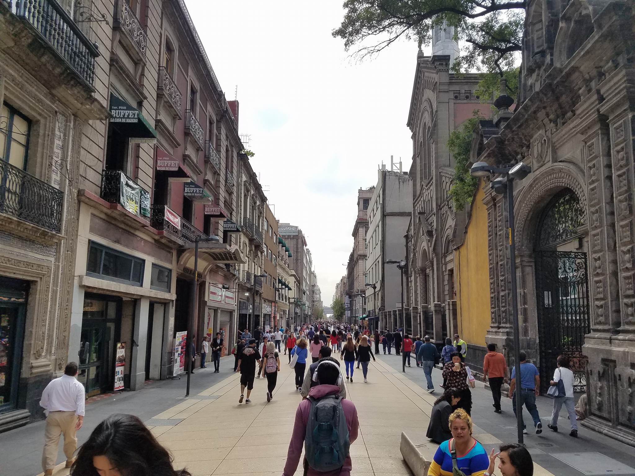
It’s like Los Angeles, but worse. To many, that’s the mental image of Mexico City: a city of unending traffic, unbearable smog, and unrestrained horizontal expansion. Yet when one walks the streets of Mexico City, a distinct reality comes into view: a city of wide sidewalks and integrated bike lanes, lush parks and cool street tree canopies, and dense, mixed-use urban neighborhoods. As a matter of fact, nearly every neighborhood within Mexico City’s giant ring road—the Circuito Interior—has a walkscore above 95. Many major U.S. cities lack even one neighborhood with such a high score. Even on the outer fringe of Mexico’s sprawling Distrito Federal, neighborhoods often have walkscores upwards of 70, qualifying as “very walkable.” What makes Mexico City so walkable?
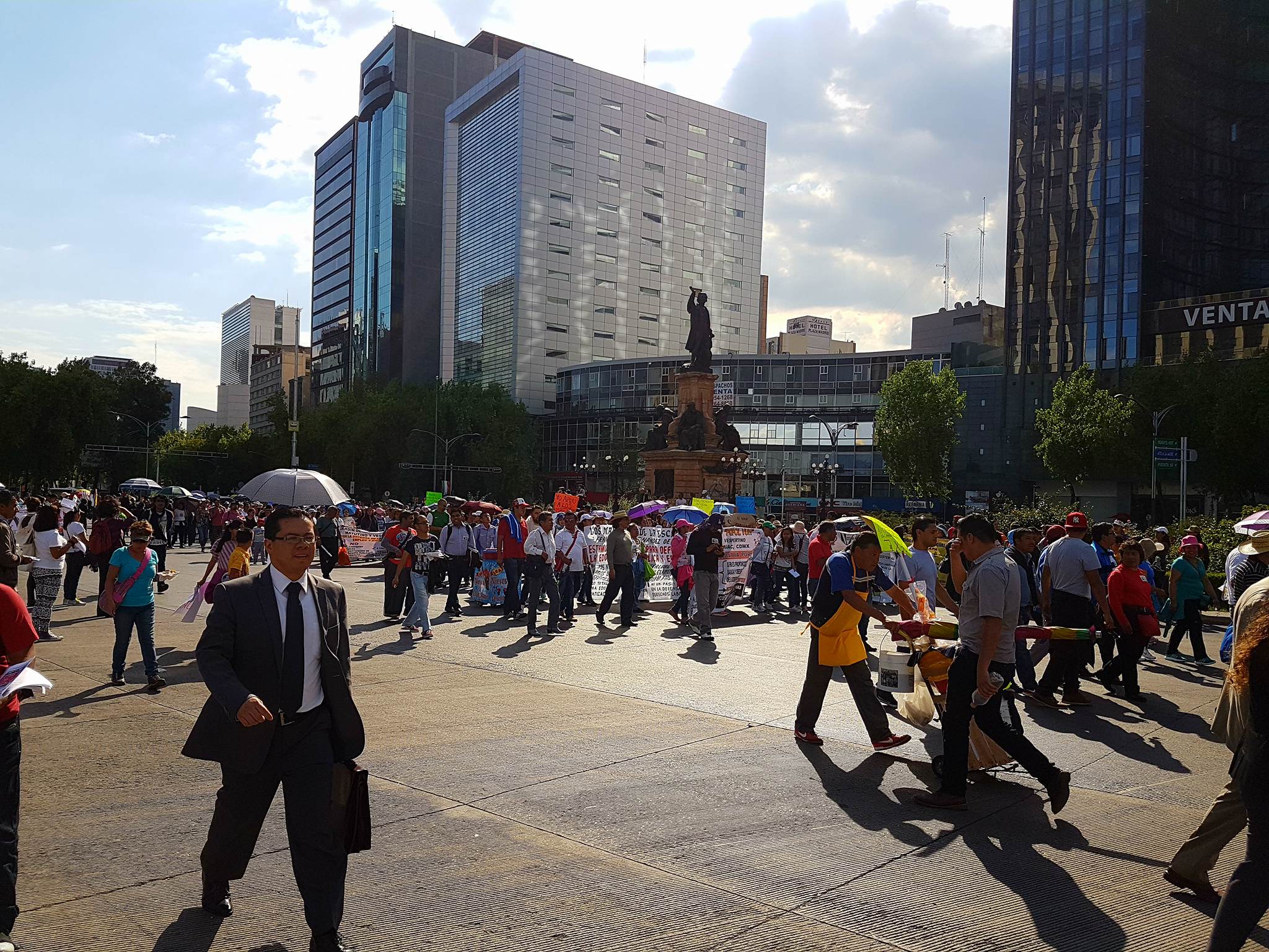
The first thing an American might notice about Mexico City is just how busy the city’s sidewalks are. It’s a city of 21,339,781, and it shows. But this busyness isn’t a mere side-effect of size; it’s a natural result of the city’s generous sidewalks and high-quality pedestrian infrastructure. Many downtown roads host spacious sidewalks, accommodating an unending sidewalk ballet of commuters, tourists, and street vendors. Wide medians along major boulevards offer both refuge for crossing pedestrians and a public space in which people are encouraged to meet and relax. Many of the city’s busiest downtown areas have been closed to automobile traffic. Mexico City’s main road—Paseo de la Reforma—is reserved on Sundays for pedestrians and cyclists. “Jaywalking” is normal and in many cases is assisted by traffic police—a stark contrast to the near persecution pedestrians often face in U.S. cities. The ample space for pedestrians attracts not only foot traffic but also the people watchers who come to enjoy the vitality, in turn keeping many downtown neighborhoods safe well into the night.
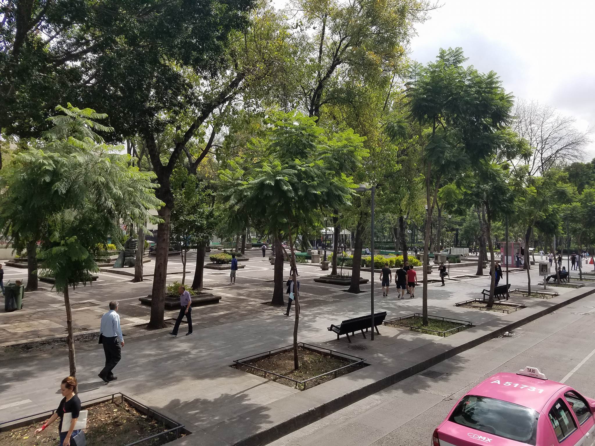
The city’s high elevation and tropical location makes for a city that is both lush in vegetation and mild in temperature. Parks and wide medians offer public spaces in which pedestrians and cyclists can travel without the hustle and bustle of congested sidewalks or speeding automobiles. The trees that city officials have planted along nearly every street keep walking cool and comfortable. The cool temperatures in turn encourage the casual mixture of public and private space; cafes and restaurants playfully overflow onto sidewalks and into parks, as street vendors sell everything from school supplies to lunch to newspapers. The city’s relaxed attitude toward street vendors and food carts adds to the liveliness of many public spaces while providing entrepreneurs an inexpensive way to start small businesses.
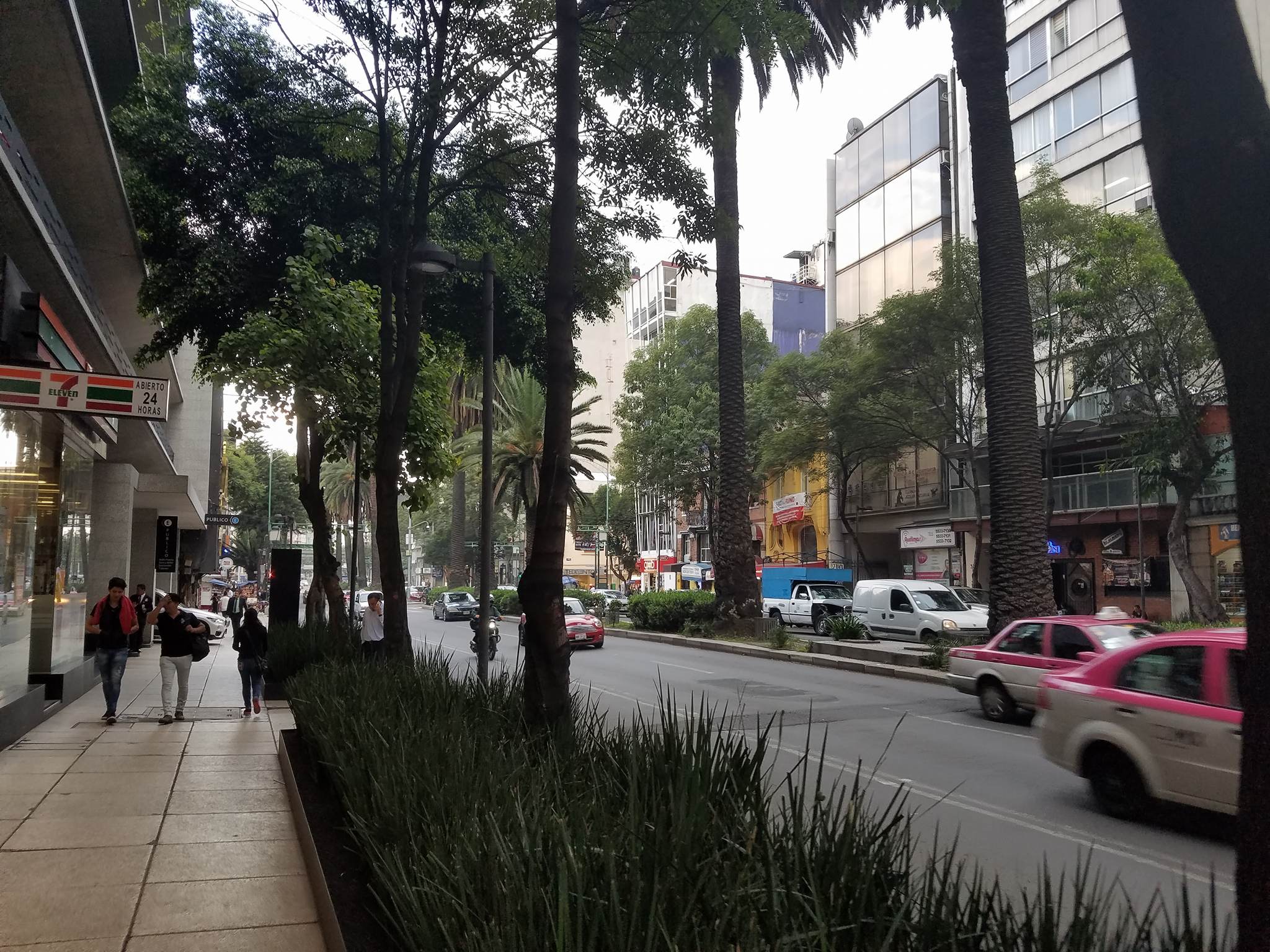
Perhaps the key to Mexico City’s walkability is the city’s incredible mixture of urban uses. In addition to the standard cornucopia of street vendors, one finds groceries, specialty shops, cafes, and restaurants along nearly every major road in the city. Whether spontaneously or by design, development along such roads often takes the form of apartments above retail—the traditional form of urban development that is prohibited in many U.S. cities. Beyond the main roads, one finds similar mixtures among housing types: high-rise apartments next to townhouses next to single-family homes, with high lot coverage in nearly every case. Where in many U.S. cities open space is regulated into every single lot through floor area ratio regulations, Mexico City’s developments are dense and public space is efficiently relegated to the city’s ample parks and public spaces. This density and mixture of uses keeps sidewalks busy and safe at nearly all hours of the day.
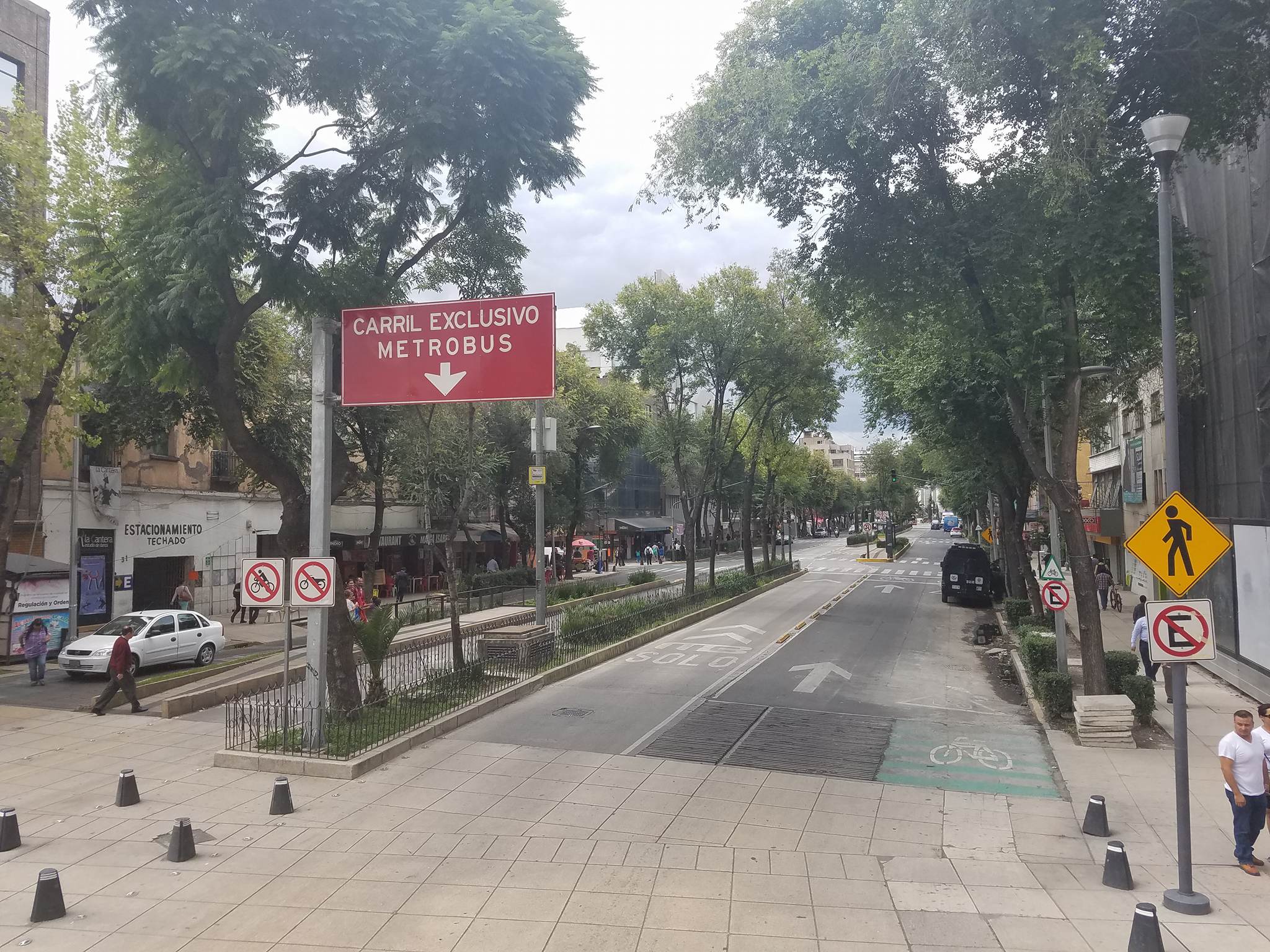
Mexico City’s walkability has been achieved in a large part by the city’s efforts to produce residents with choice in transportation. As walkability evangelist Jeff Speck argues in his book Walkable City: How Downtown Can Save America, One Step at a Time, “walkable neighborhoods can thrive in the absence of transit, but walkable cities rely on it utterly.” Whether in the form of walking or driving, bus or train, it’s easy for car-free capitalinos to move from neighborhood to neighborhood. Pedestrians in Mexico City also benefit from an enormous public push in recent years to improve bikeability. Not only has the city installed over 90 miles of attractive, well-protected bike lanes around the city; it has also encouraged bike use through large campaigns. In 2010, Mexico City began installing the fourth largest bike sharing service in the world, providing over 6,000 bikes spread across more than 452 stations around the city. The service, Ecobici, now has over 100,000 users belonging to every income group. Thanks to these ambitious—yet relatively inexpensive—projects, Mexico City is credited for starting the “Biking Revolution of Latin America.”
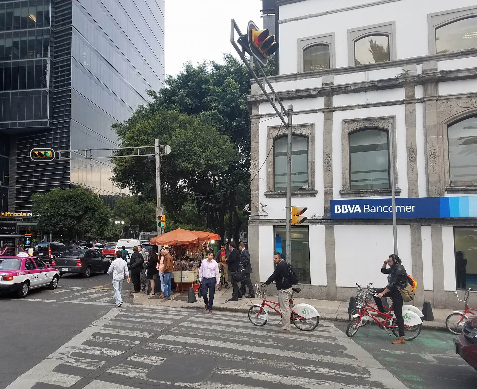
Perhaps the key lesson that U.S. cities could learn from Mexico City is that walkability isn’t impossible in the age of automobiles. Like many cities that boomed in the post-war era—think Sun Belt cities like Atlanta, Houston, Phoenix, and Los Angeles—Mexico City rapidly burst outward and residents grew more and more car-dependent from the 1960s through the 1990s. What makes Mexico City special is that its policymakers, civic groups, and businesses embraced the natural walkability that survived this boom and developed the new urban innovations—including bus rapid transit and the city’s now famous pedestrianizaition of streets—needed to keep the city both urban and mobile. As demagogues in the U.S. fret about the purported “mexification” of America, one can’t help but hope that Latin American immigrants bring with them some of their wisdom on walkability and urbanization.
I’d love to share my thoughts with mr Nolan, but Twitter is not really a place where I can demonstrate what a piece of hogwash he’s come up with. Before waxing philosphical about a city without going to the trouble of getting to know the place in some depth, he should at least get his few facts straight.
Item 1. The second picture, the Columbus circle of the Paseo de la Reforma avenue, looks like what he claims to be true, a city with “generous sidewalks and high-quality pedestrian infrastructure” because a demonstration is going on (left to right) and you only get to see pedestrians in areas where you would have normally have a non-stop stream of cars, trucks, taxis and buses.
Item 2. The third picture is not in Colonia Roma; it is Florencia avenue in the very touristy Zona Rosa, and if you click the link below to look at the same spot in Google Maps’ street view, you’ll see the amount of truth to mr Nolan’s claim that “medians along major boulevards offer both refuge for crossing pedestrians and a public space in which people are encouraged to meet and relax”. As far as I am concerned, every time I’ve found myself on that particular median conditions have only encouraged me to get the hell out of there as fast as possible.
Street View: https://www.google.com.mx/maps/@19.4249343,-99.1665075,3a,75y,153.18h,87.43t/data=!3m6!1e1!3m4!1sh9R6sjTInXKLKX8mTslhlg!2e0!7i13312!8i6656
Item 3. As for jaywalking, the whole of the median along Paseo de la Reforma from the Museum of Modern Art to the intersection with Juarez avenue, a two mile stretch where traffic is at its densest, was amiably discouraged more than twelve years ago with concrete pyramids which would challenge even a caterpillar driven vehicle (I invite anyone who might think I am exaggerating to peruse Googlemaps).
Mr Nolan’s should have thought it twice before claiming fame to Mexico City’s pedestrianization, before using as a source a text published four years ago, where the author gives credit of such a process to a former major who is these days living in Paris to stay clear of the famously weak and corruptible arm of Mexican justice.
Absolute tripe. As a pedestrian living in Mexico City this is a very small exception and not the rule.
As a former resident of Mexico City/D.F., this article reads as a cartoonish gloss on reality and blatantly ignores socioeconomic disparities. The majority of residents travel hours on their daily commute, given how expensive housing in the central “walkable” areas of the city like Zona Roma or Condesa has become. This travel is often a combination of informal and formal bus services and walking, given the high costs of owning/maintaining a private car, which might be why the author observes so many people on the streets. Cars have little respect or awareness of pedestrians, including virtually no acceptance of crosswalks, which is one manifestation of longstanding power inequalities (i.e. if you are in a car, you are inherently in a position of greater power and arguable wealth, so why would you give up that position by yielding to a pedestrian?). Yes, certain neighborhoods like the mentioned Roma or Condesa have been recast as pedestrian zones where you can live/work/eat/socialize, but these are the rare exception – almost inaccessible to the majority of the city’s residents in cost and increasingly occupied by high-end condos intended for expats. Another example of this disproportionate investment is the recent work done on Avenida Masaryk in Polanco to make it more pedestrian-friendly: an incredibly expensive public renovation that services only the socioeconomic elite (Masaryk is a very high-end shopping district with stores like Cartier, etc.) and tourists. It is important to look at the complexity of such issues before lauding a city’s improvement so that real concerns of accessibility can be more accurately addressed.
[…] course, these qualities aren’t unique to the border; they are common throughout Mexico and much the rest of Latin America. They result from Mexico’s one-time status as a Spanish […]
This is right though, you can walk anywhere and find services even way out in the suburbs in mexico, its due to no zoning laws maybe?