Physical Address
304 North Cardinal St.
Dorchester Center, MA 02124
Physical Address
304 North Cardinal St.
Dorchester Center, MA 02124

Liberalizing Cities
From The Ground Up
Headlines last month proclaimed that “Cities Have Grown More Diverse, And More Segregated, Since the 90s.” The headlines originate in the key findings of a new, detailed study from the Othering and Belonging Institute (OBI) at UC Berkeley. The study leans heavily on a relatively new metric – the Divergence Index – which has impressed many researchers (myself included) with its versatility. But now that we have seen the Divergence Index in action, its versatility clearly comes at a cost: the Divergence Index conflates what we would intuitively call diversity with “segregation.” As a result, more-diverse metro areas are usually ranked as more segregated by the Divergence Index. And as America became far more diverse over the past 30 years, it is logical that the Divergence Index would rise in most metro areas. Why is it so hard to measure segregation? Racial segregation is easy to see. You walk down the street and almost everybody in one neighborhood looks different than you and almost everybody in another neighborhood looks the same as you. The human eye and ear can also distinguish categories that are meaningful in some contexts but not others. Everybody but me in the café where I watched European soccer last week appeared to be not only Black but specifically Ethiopian. Was that café integrated or segregated? I certainly felt welcome as I bantered at the bar with an Ethiopian-American tennis instructor. But statistically, the café was far more Black and vastly more Ethiopian than the D.C. region as a whole. In this context, “segregation” refers to places where one group is overrepresented – like the café – not to the legal regime that imposed second-class citizenship and pervaded every aspect of life for black Americans. Given the word’s loaded history, it would have been wiser for social […]
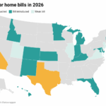
Over the years, I’ve heard a wide variety of arguments against new housing. One of them is the “mysterious foreign investor” argument. According to this theory, new urban housing will all be bought up by billionaire foreign investors, who will purchase the property and never rent it out, thus preventing the new housing from increasing supply. (I have rebutted the argument here).* A variation of the argument is that because some high-end housing is vacant, supply is therefore adequate to meet demand. (I have addressed this idea here). Another argument is that housing markets are segmented: that if you increase the supply at the top of the market, it will not help anyone who is not already at the top of the market. It seems to me that these arguments contradict each other: the first argument is based on the idea that high-end housing does affect the market as a whole (or would if rich people stopped using apartments as second homes); the second is based on the idea that high-end housing doesn’t affect the rest of the market at all. *In addition, I have recently published a much longer article in the New Mexico Law Review, discussing the pros and cons of high-end condos.
There was an interesting article in the New York Times magazine this week on the rise of extended stay hotels, which specialize in renting to a group within the working poor- people who have the cash for weekly rent, but cannot easily rent traditional apartments due to their poor credit ratings. This seems like a public necessity – but even here the long arm of big government seeks to smash affordability. The article notes that Columbus, Ohio “passed an ordinance that subjects them to many of the same regulations as apartments” because “The hotels had an unfair competitive advantage.” In other words, the city is basically rewarding landlords for turning out bad-credit tenants, and punishing the hotels who seek to house them.
The best book on zoning and NIMBYism you’ve never read might well be The Housing Bias by Paul Boudreaux. The author is a law professor, but you’d be forgiven for thinking he’s a journalist. His writing is engaging – and occasionally funny – and he does what is unthinkable for many scholars: drives to various places to interview people who are engaged in the (legal) drama of what we now call “the housing crisis.” Boudreaux had the misfortune of being ahead of his time. The housing market was so soft in 2011 that his book landed with nary a sound. A quick web search turned up no book reviews besides the publisher’s blurbs. The book (and you’ll be forgiven if you stop reading right here) will set you back. That’s unfortunate. Just a few years later, the book would have connected with passions shared by the rapidly growing YIMBY movement and a publisher would have marketed it to the masses. Boudreaux’s thesis is that “the laws that govern our use of land are biased in favor of one specific group of Americans—affluent, home-owning families—who least need the government’s help.” He keeps his ideological cards close to the vest. But that’s the point: one need not lean left or right to want to stop using the power of the state to comfort the comfortable and afflict the afflicted. The first chapter is the most important, because it lays out the foundation for all that local governments do, good and bad, in land use: the police power. He’s writing from Manassas, Virginia, where “restaurants with Aztec pyramids on them” telegraph the large Hispanic immigrant community. A vocal minority opposed this local immigration, and pressured local governments to stop it. Of course, the city doesn’t issue passports, but the police power allows local […]
Christian Hilber and Andreas Mense argue that the price to rent ratio only increases with a demand shock where supply is sufficiently constrained
After over a century, Berkeley, California may be about to legalize missing middle housing – and it’s not alone. Bids to re-legalize gradual densification in the form of duplexes, triplexes, fourplexes, and the like have begun to pick up steam over the last several years. In 2019, Oregon legalized these housing types statewide while Minneapolis did the same at the city level. In 2020, Virginia and Maryland both tried to pass similar legislation, though they ultimately failed. This year, though, Montana and California may pick up the torch with their own state bills (even while the cities of Sacramento and South San Francisco consider liberalizing unilaterally alongside Berkeley). Allowing gradual densification is an absolutely necessary step towards general affordability. Supply, demand, and price form an iron triangle–the more responsive we can make supply to demand, the less price will spike to make up the difference.* What I really want to focus on here, though, is less about policy and more about political economy. I believe allowing medium-intensity residential development could make additional reforms easier to achieve and change views around development going into the future. We Love What We Know More often than not, I think a generalized status quo bias explains a lot of NIMBYism. Homeowners are most comfortable with their neighborhoods as they are now and are accustomed to the idea that they have the right to veto any substantial changes. Legalizing forms of incrementally more intense development could re-anchor homeowners on gradual change and development as the norm. The first part of the story is about generational turnover. If the individuals buying homes today–and the cohorts that follow–are exposed to gradually densifying neighborhoods in their day-to-day, they’ll anchor on that as what’s normal and therefore acceptable. Moreover, if we’re debating whether to rezone an area for mid-rise […]
A recent paper by UCLA researchers discusses 2019-20 literature on the relationship between new construction and rents. The article discusses five papers; four of them found that new housing consistently lowers rents in nearby buildings. For example, Kate Pennington wrote a paper on the relationship between new construction and housing costs in San Francisco. What is unique about this paper is that while other papers focus on a broad sample of new construction, Pennington focuses on one subset of the market: “new construction caused by serious building fires.” Why? Because most new construction is in high-demand areas. Any study that focuses on such construction will be more likely to conclude that the new construction is related to high rents, when in fact the real cause of increased rents is increased demand for certain neighborhoods. Pennington found that rents actually decreased within 500 meters of new buildings- by 2.3 percent, compared to similar blocks without new buildings. Pennington also found 17.1 percent less displacement (which she defines as moves to poorer zipcodes) near the new buildings, and found that landlords were less likely to evict rent-controlled tenants. One paper was a partial exception to the pro-supply trend of recent scholarship: a paper by Anthony Damiano and Chris Frenier found that new buildings in Minneapolis lowered rents for most nearby buildings, but increased rents for the cheapest buildings. But the UCLA researches point out that “Damiano and Frenier do not adjust the rents in their study for inflation, which is an unusual decision, and one that makes the rent increases they report look much larger than they actually were.” Adjusted for inflation, rents near new buildings declined by 7 percent overall, and increased by only 0.2 percent for the cheapest buildings. One point that the UCLA researches do not mention: although the […]

Night City: the cyberpunk themed sandbox of William Gibson’s darkest tech-themed dreams, and despite the host of game-breaking glitches, home to all the anti-urban nightmares that the genre helped spawn. In this episode of Pop Culture Urbanism, I dig deep into the cyberpunk genre, the era that spawned and popularized it, and subsequent “unseen” opportunity cost of de-urbanization that continues to haunt us to this day. Be sure to follow future episodes by subscribing to the Pacific Legal Foundation on YouTube! We have a lot of content in the hopper that you won’t want to miss. Directed by Calvin Tran and produced by our friends at the Pacific Legal Foundation.
A major barrier to the market urbanist’s ability to make the case for building more housing is the question of aesthetics. When you refer to density in cities, it’s easy to picture large brutalist towers and the slum-like conditions that can be seen in much of the developing world. Of course, this isn’t what we advocate, but it is a problem we have to repeatedly address. Homeowners, whether we like it or not, are a powerful voter group and they want to live in areas that look nice. Fortunately, the British Government has found the golden mean of housing plans by accepting the results of the Building Better, Building Beautifully Commission.. The key takeaway of this report is street-voting. This represents an excellent middle ground between the seemingly opposite need for housing to be popular, and the need for housing to be plentiful. The current system used in England fails to provide a fair way of measuring public views on plans. This works by assessing the views of nearby residents through a consultation. This allows any resident to attend, or write in, laying out their views on the plan. It may sound democratic, but local consultations are notoriously unrepresentative of a community. Those who take part are overwhelmingly middle-class, property-owning white people who stand to benefit from a housing shortage. Rather than taking into account the views of the local area, this method merely measures the views of those who would be economically burdened by addressing the crisis. The city as a commons What we’re left with is what social scientists would call the tragedy of the commons. This is where you have a common-pool resource where individual use of that resource depletes the stock for other parties. Cities can also be understood to be “the commons” in that they […]

Welcome to Twin Peaks: home of black coffee, cherry pie, murder, intrigue, and the endangered pine weasel. To kick off season two of Pop Culture Urbanism, I dive into David Lynch’s eccentric nightmare/daytime soap opera world to examine the age old trope of the bad guy developer and how they manipulate environmental regulation to their financial advantage. Video goes live at noon PT 1/28! Be sure to follow future episodes by subscribing to the Pacific Legal Foundation on YouTube! We have a lot of content in the hopper that you won’t want to miss. For the New Urbs article that inspired this video, click here.